
Betzenstein
91282 Betzenstein, Deutschland
Hiking Parking Lot Spies | Eibgrat & Hiking Trails
The Hiking Parking Lot Spies is the first point of contact for many hikers in the Franconian Switzerland with the Eibgrat and the surrounding trails around Betzenstein. It is not a classic excursion parking lot with much staging, but a functional, nature-oriented starting point that primarily offers one thing: a quick transition from the car to the landscape. The town of Betzenstein refers to it in connection with the Eibgrat and simultaneously points to the hiking overview boards that provide orientation on site. This makes the parking lot particularly interesting for people who like to start walking directly and want to enter a marked tour without detours. Depending on the search query, the place appears in slightly varying spellings, such as with Spieß variants, but in content, it is always about the same access to the hiking area at Spies. For this reason, the parking lot is an important point of orientation for hikers looking for Eibgrat, Green Ring routes, or longer connections towards Betzenstein. ([betzenstein.de](https://www.betzenstein.de/tourismus-freizeit/wandern-und-radfahren/rundwanderwege/wanderweg-roter-querstrich/))
Access and Parking at the Hiking Parking Lot Spies
The official description from the town of Betzenstein is clear and practical for access: Coming from Betzenstein, the Hiking Parking Lot Spies is located about 400 meters before the entrance to the town. In a right curve, you turn left and then drive about 200 meters to the edge of the forest. This location makes the spot so attractive, as it is close enough to the road but still embedded in the quiet forest and rock landscape at the edge of Spies. Those visiting the area for the first time particularly benefit from the fact that the starting point does not have to be sought in the town center but is directly at the access to the hiking region. On the municipal side, the spot is also classified as a hiking parking lot at the Eibgrat in Spies; in other directions, the term Hiking Parking Lot Eibgrat WEST appears when tours should keep the asphalt portion as short as possible. These different designations indicate a very local, route-adapted use and show that the parking lot is closely connected to the western access to the Eibgrat. ([betzenstein.de](https://www.betzenstein.de/tourismus-freizeit/wandern-und-radfahren/rundwanderwege/wanderweg-roter-querstrich/))
For practical planning, it is important to note that the Hiking Parking Lot Spies primarily serves as a starting point for hikes and not as isolated infrastructure. That is why you will find overview boards at several points in the municipality's official hiking information, including directly at the Hiking Parking Lot at the Eibgrat in Spies. So, upon arrival, you can inform yourself about starting points, markings, and sensible round tours on site without having to memorize everything in advance. Additionally, the town refers to informational material available at the Tourist Info in the Historical Maasenhaus in Betzenstein. Thus, the parking lot is not just a place to park but part of a small path system that consciously relies on self-orientation in the terrain. In practice, this means: Once you have turned correctly, you quickly find yourself at the entrance to nature and can choose from tours with short, medium, or longer distances. ([betzenstein.de](https://www.betzenstein.de/tourismus-freizeit/wandern-und-radfahren/rundwanderwege/?utm_source=openai))
Eibgrat: Challenging Rock Trail Directly from the Parking Lot
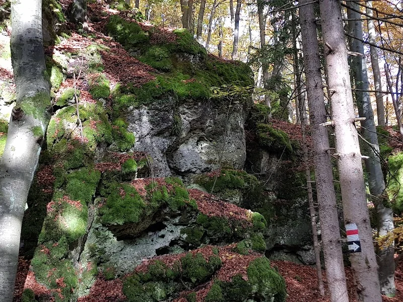
The most well-known reason to head to the Hiking Parking Lot Spies is the Eibgrat. The town of Betzenstein explicitly describes it not as a circular trail but as a rock trail that can only be combined with the Green Ring to form a beautiful circular hike. This is what gives it its special quality: The Eibgrat is not a leisurely stroll but a short but intense section through rocks, crevices, and narrow passages that conveys the impression of a real little mountain tour. Those who start here experience a lot of character over a relatively short distance. The town describes the trail as about one kilometer long and emphasizes that it is challenging. The path goes through shaded areas of large beech trees, over rock ridges, and past slopes; at the highest point, there is a resting bench with a view of the Eibtaler Wall rock mass. This mixture of nature experience, steepness, and view makes the charm of the Eibgrat and explains why the Hiking Parking Lot Spies is for many not just a parking lot but the beginning of a small adventure. ([betzenstein.de](https://www.betzenstein.de/tourismus-freizeit/wandern-und-radfahren/rundwanderwege/wanderweg-roter-querstrich/))
At the same time, the official communication remains very clear regarding safety and target audience. The Eibgrat requires sturdy, slip-resistant footwear as well as climbing skills and a head for heights at some points. According to the town, the trail is not suitable for small children; older children should only be accompanied by adults. Those who do not wish to engage in more difficult passages can bypass the rock heads on a small path at the foot of the rocks. The town also points out that the ground can become slippery when wet or damp. These warnings are not trivial but crucial for making a good tour decision. The Eibgrat is so popular precisely because it is not arbitrary: it demands attention but rewards with a very immediate rock and forest atmosphere. Those seeking this will find one of the most exciting accesses in the Betzenstein region at the Hiking Parking Lot Spies. ([betzenstein.de](https://www.betzenstein.de/tourismus-freizeit/wandern-und-radfahren/rundwanderwege/wanderweg-roter-querstrich/))
Which Hiking Trails Start from the Hiking Parking Lot Spies
The Hiking Parking Lot Spies is not only the starting point for the Eibgrat but part of a significantly larger network of trails. Particularly important is the loop described by the town over the Red Cross Trail. It leads from the parking lot over the Eibgrat and then back over the Green Ring. The total length is about 4 kilometers, making the tour a compact but impressive loop that is well-suited for a half day of hiking. Also relevant is the Hohe-Reuth circular trail, which is marked with the Green Ring and is one of the varied circular trails in the southern municipality area. It runs through Schermshöhe, Spies, Eichenstruth, and Illafeld, is 11.5 kilometers long, and can be entered at several points. The official information mentions, among other things, the Hiking Parking Lot Eibgrat West and the parking lot at the fire station in Schermshöhe for this purpose. This makes it clear: The area around Spies is not reduced to a single short rock route but functions as a hub of a larger, interconnected hiking area. ([betzenstein.de](https://www.betzenstein.de/tourismus-freizeit/wandern-und-radfahren/rundwanderwege/wanderweg-roter-querstrich/))
The Blue Cross Trail also plays an important role for the position of the Hiking Parking Lot. The town describes the southern route as a connection Spies - Reuthof - Betzenstein with a length of 7 kilometers. Those who want to avoid the paved road as much as possible can start from the Hiking Parking Lot Eibgrat WEST according to the official description. From there, the path leads over the so-called Plechensteig through the Eibental, further up to Reuthof and then towards Betzenstein. For the return journey, the town recommends the Green Cross Trail, which leads back to the Hiking Parking Lot via Waiganz and Hetzendorf. This makes it clear that the Hiking Parking Lot Spies is not intended for just a single highlight tour but as a practical starting point for various directions and difficulty levels. Depending on the desire for rock, forest, elevation, or circular trail, the tour planning can be very flexible here. ([betzenstein.de](https://www.betzenstein.de/tourismus-freizeit/wandern-und-radfahren/zielwanderwege/wanderweg-blauer-querstrich/))
Orientation, Markings, and Overview Boards on Site
Upon arriving at the Hiking Parking Lot Spies, you will find, according to the town of Betzenstein, not only the access to the edge of the forest but also the necessary orientation for entering the trail network. In the overview of target hiking trails, the Hiking Parking Lot at the Eibgrat in Spies is explicitly mentioned as a location for a hiking overview board. Such boards are particularly valuable for practice because they make starting points, directions, and markings immediately visible. This is often more helpful in the terrain than a route learned only roughly in advance, as the hiking area around Spies works with color symbols and line markings that can be directly assigned on site. The town also points out that informational material is available at the Tourist Info in the Historical Maasenhaus in Betzenstein. Thus, the infrastructure is simple but sensibly structured: Those who want to prepare can inform themselves; those who start spontaneously receive the most important information directly on the path. This mix of outdoor proximity and clear municipal wayfinding makes the location very practical for hikers. ([betzenstein.de](https://www.betzenstein.de/tourismus-freizeit/wandern-und-radfahren/rundwanderwege/?utm_source=openai))
The markings themselves are a large part of the user experience. For the Eibgrat, the town names the Red Cross Trail as the outbound path and the Green Ring as the return path. The Hohe-Reuth circular trail is marked with the Green Ring, and the Blue Cross Trail connects Spies with Reuthof and Betzenstein. Those who visit the area more frequently quickly notice that the paths logically build on each other: short rock trail, subsequent forest and field paths, return on familiar loops, with entry points at several locations. This creates a hiking network that works for both spontaneous half-day trips and longer circular tours. The official descriptions are rather practical than spectacularly formulated, which fits well with the landscape. You should not get lost but know exactly where the entrance is, which direction is meant, and how to safely return. This is a real advantage, especially for guests who are not familiar with the area. ([betzenstein.de](https://www.betzenstein.de/tourismus-freizeit/wandern-und-radfahren/rundwanderwege/wanderweg-roter-querstrich/))
Safety, Rescue Zones, and the Right Equipment
At the Eibgrat, safety plays a larger role than at many other hiking destinations in the region. The town of Betzenstein points out on the Eibgrat page that the trail requires sturdy, slip-resistant footwear and, at some points, climbing skills and a head for heights. Especially on wet or damp ground, the rocks can become slippery, which is why caution is expressly recommended. These warnings are important because the appeal of the path arises precisely from its wild character, not from an artificially secured attraction. Those who start with the wrong footwear or without realistic self-assessment quickly make the tour unnecessarily difficult. For families, this means: Only those who are sufficiently sure-footed and fit should actively tackle the trail. The town also makes it clear that inexperienced hikers can bypass the rock heads at the foot of the rocks. This is a sensible compromise because it allows one to experience the landscape without having to go through every difficult spot. This keeps the Eibgrat accessible without losing its characteristic difficulty. ([betzenstein.de](https://www.betzenstein.de/tourismus-freizeit/wandern-und-radfahren/rundwanderwege/wanderweg-roter-querstrich/))
Additionally relevant are the rescue zones. The mountain rescue service Pottenstein has divided the Eibgrat into five rescue zones to facilitate quicker assistance in emergencies. The town emphasizes that one should remember whether they have approached the trail from the west via the Parking Lot Spies or from the east via the Parking Lot Riegelstein/Plech and, in case of emergency, to mention the last zone passed. The emergency number is 112. For hikers, this initially sounds technical but is practically very helpful, as it shortens the search in case of emergency and facilitates rescue. This combination of natural rock trail and clearly regulated emergency structure shows how seriously the area is taken as a hiking space. Those who start prepared not only have the more beautiful but also the safer outing. Thus, at the Hiking Parking Lot Spies, not only does a tour begin, but also a responsibility for good equipment, realistic tour choices, and attention in the terrain. ([betzenstein.de](https://www.betzenstein.de/tourismus-freizeit/wandern-und-radfahren/rundwanderwege/wanderweg-roter-querstrich/rettungszonen-eibgrat/))
Spies, the Spieser Rocks, and the Hiking Area around Betzenstein
The Hiking Parking Lot Spies is not located in just any forest zone but in a place with strong landscape and historical character. Above the village of Spies rise the Spieser Rocks, which the town of Betzenstein describes as a popular excursion destination in the Franconian Alb for decades. Here, the traces of the former Spies Castle can be found. This gives the parking lot another context: it is not only access to hiking trails but also to the history of the place and its rocky landscape. The municipal history page describes the Spies Castle as a former castle with early documentation in the 14th century but also mentions older name forms of the family. According to the town, the castle first appears in records in 1346; it was later destroyed in 1397 and burned down again in 1553 during the Second Margrave War. Today, ruins and rock formations remain as visible traces of a much older settlement and rule history. So, those starting at the Hiking Parking Lot move through a landscape where nature and history are closely intertwined. ([betzenstein.de](https://www.betzenstein.de/betzenstein/geschichte/denkmaeler/burgen-und-burgruinen/burgruine-spies/))
The surrounding landscape is also remarkable. The town of Betzenstein describes the Hohe Reuth on the Hohe-Reuth circular trail as a 635-meter-high elevation and at the same time as the highest elevation in Franconian Switzerland. In the same circular trail, Spies, Eichenstruth, and Illafeld are connected, so the place does not appear isolated but embedded in a larger municipal area. Additionally, the area is part of a well-known hiking region, where the Franconian Mountain Trail runs and leads over the Hohe Reuth at Spies. So, those who set off from the Hiking Parking Lot here experience not just a single viewpoint but a whole cultural landscape of rocks, forests, villages, and ridges. This is precisely what makes the location so interesting for hikers: short, intense paths like the Eibgrat, longer circular tours over the Green Ring, and connections towards Betzenstein can be meaningfully combined here. The Hiking Parking Lot Spies is thus a good starting point for all who want to not just look at Franconian Switzerland but actively traverse it. ([betzenstein.de](https://www.betzenstein.de/tourismus-freizeit/wandern-und-radfahren/rundwanderwege/wanderweg-gruener-ring/))
Sources:
Show moreShow less
Hiking Parking Lot Spies | Eibgrat & Hiking Trails
The Hiking Parking Lot Spies is the first point of contact for many hikers in the Franconian Switzerland with the Eibgrat and the surrounding trails around Betzenstein. It is not a classic excursion parking lot with much staging, but a functional, nature-oriented starting point that primarily offers one thing: a quick transition from the car to the landscape. The town of Betzenstein refers to it in connection with the Eibgrat and simultaneously points to the hiking overview boards that provide orientation on site. This makes the parking lot particularly interesting for people who like to start walking directly and want to enter a marked tour without detours. Depending on the search query, the place appears in slightly varying spellings, such as with Spieß variants, but in content, it is always about the same access to the hiking area at Spies. For this reason, the parking lot is an important point of orientation for hikers looking for Eibgrat, Green Ring routes, or longer connections towards Betzenstein. ([betzenstein.de](https://www.betzenstein.de/tourismus-freizeit/wandern-und-radfahren/rundwanderwege/wanderweg-roter-querstrich/))
Access and Parking at the Hiking Parking Lot Spies
The official description from the town of Betzenstein is clear and practical for access: Coming from Betzenstein, the Hiking Parking Lot Spies is located about 400 meters before the entrance to the town. In a right curve, you turn left and then drive about 200 meters to the edge of the forest. This location makes the spot so attractive, as it is close enough to the road but still embedded in the quiet forest and rock landscape at the edge of Spies. Those visiting the area for the first time particularly benefit from the fact that the starting point does not have to be sought in the town center but is directly at the access to the hiking region. On the municipal side, the spot is also classified as a hiking parking lot at the Eibgrat in Spies; in other directions, the term Hiking Parking Lot Eibgrat WEST appears when tours should keep the asphalt portion as short as possible. These different designations indicate a very local, route-adapted use and show that the parking lot is closely connected to the western access to the Eibgrat. ([betzenstein.de](https://www.betzenstein.de/tourismus-freizeit/wandern-und-radfahren/rundwanderwege/wanderweg-roter-querstrich/))
For practical planning, it is important to note that the Hiking Parking Lot Spies primarily serves as a starting point for hikes and not as isolated infrastructure. That is why you will find overview boards at several points in the municipality's official hiking information, including directly at the Hiking Parking Lot at the Eibgrat in Spies. So, upon arrival, you can inform yourself about starting points, markings, and sensible round tours on site without having to memorize everything in advance. Additionally, the town refers to informational material available at the Tourist Info in the Historical Maasenhaus in Betzenstein. Thus, the parking lot is not just a place to park but part of a small path system that consciously relies on self-orientation in the terrain. In practice, this means: Once you have turned correctly, you quickly find yourself at the entrance to nature and can choose from tours with short, medium, or longer distances. ([betzenstein.de](https://www.betzenstein.de/tourismus-freizeit/wandern-und-radfahren/rundwanderwege/?utm_source=openai))
Eibgrat: Challenging Rock Trail Directly from the Parking Lot
The most well-known reason to head to the Hiking Parking Lot Spies is the Eibgrat. The town of Betzenstein explicitly describes it not as a circular trail but as a rock trail that can only be combined with the Green Ring to form a beautiful circular hike. This is what gives it its special quality: The Eibgrat is not a leisurely stroll but a short but intense section through rocks, crevices, and narrow passages that conveys the impression of a real little mountain tour. Those who start here experience a lot of character over a relatively short distance. The town describes the trail as about one kilometer long and emphasizes that it is challenging. The path goes through shaded areas of large beech trees, over rock ridges, and past slopes; at the highest point, there is a resting bench with a view of the Eibtaler Wall rock mass. This mixture of nature experience, steepness, and view makes the charm of the Eibgrat and explains why the Hiking Parking Lot Spies is for many not just a parking lot but the beginning of a small adventure. ([betzenstein.de](https://www.betzenstein.de/tourismus-freizeit/wandern-und-radfahren/rundwanderwege/wanderweg-roter-querstrich/))
At the same time, the official communication remains very clear regarding safety and target audience. The Eibgrat requires sturdy, slip-resistant footwear as well as climbing skills and a head for heights at some points. According to the town, the trail is not suitable for small children; older children should only be accompanied by adults. Those who do not wish to engage in more difficult passages can bypass the rock heads on a small path at the foot of the rocks. The town also points out that the ground can become slippery when wet or damp. These warnings are not trivial but crucial for making a good tour decision. The Eibgrat is so popular precisely because it is not arbitrary: it demands attention but rewards with a very immediate rock and forest atmosphere. Those seeking this will find one of the most exciting accesses in the Betzenstein region at the Hiking Parking Lot Spies. ([betzenstein.de](https://www.betzenstein.de/tourismus-freizeit/wandern-und-radfahren/rundwanderwege/wanderweg-roter-querstrich/))
Which Hiking Trails Start from the Hiking Parking Lot Spies
The Hiking Parking Lot Spies is not only the starting point for the Eibgrat but part of a significantly larger network of trails. Particularly important is the loop described by the town over the Red Cross Trail. It leads from the parking lot over the Eibgrat and then back over the Green Ring. The total length is about 4 kilometers, making the tour a compact but impressive loop that is well-suited for a half day of hiking. Also relevant is the Hohe-Reuth circular trail, which is marked with the Green Ring and is one of the varied circular trails in the southern municipality area. It runs through Schermshöhe, Spies, Eichenstruth, and Illafeld, is 11.5 kilometers long, and can be entered at several points. The official information mentions, among other things, the Hiking Parking Lot Eibgrat West and the parking lot at the fire station in Schermshöhe for this purpose. This makes it clear: The area around Spies is not reduced to a single short rock route but functions as a hub of a larger, interconnected hiking area. ([betzenstein.de](https://www.betzenstein.de/tourismus-freizeit/wandern-und-radfahren/rundwanderwege/wanderweg-roter-querstrich/))
The Blue Cross Trail also plays an important role for the position of the Hiking Parking Lot. The town describes the southern route as a connection Spies - Reuthof - Betzenstein with a length of 7 kilometers. Those who want to avoid the paved road as much as possible can start from the Hiking Parking Lot Eibgrat WEST according to the official description. From there, the path leads over the so-called Plechensteig through the Eibental, further up to Reuthof and then towards Betzenstein. For the return journey, the town recommends the Green Cross Trail, which leads back to the Hiking Parking Lot via Waiganz and Hetzendorf. This makes it clear that the Hiking Parking Lot Spies is not intended for just a single highlight tour but as a practical starting point for various directions and difficulty levels. Depending on the desire for rock, forest, elevation, or circular trail, the tour planning can be very flexible here. ([betzenstein.de](https://www.betzenstein.de/tourismus-freizeit/wandern-und-radfahren/zielwanderwege/wanderweg-blauer-querstrich/))
Orientation, Markings, and Overview Boards on Site
Upon arriving at the Hiking Parking Lot Spies, you will find, according to the town of Betzenstein, not only the access to the edge of the forest but also the necessary orientation for entering the trail network. In the overview of target hiking trails, the Hiking Parking Lot at the Eibgrat in Spies is explicitly mentioned as a location for a hiking overview board. Such boards are particularly valuable for practice because they make starting points, directions, and markings immediately visible. This is often more helpful in the terrain than a route learned only roughly in advance, as the hiking area around Spies works with color symbols and line markings that can be directly assigned on site. The town also points out that informational material is available at the Tourist Info in the Historical Maasenhaus in Betzenstein. Thus, the infrastructure is simple but sensibly structured: Those who want to prepare can inform themselves; those who start spontaneously receive the most important information directly on the path. This mix of outdoor proximity and clear municipal wayfinding makes the location very practical for hikers. ([betzenstein.de](https://www.betzenstein.de/tourismus-freizeit/wandern-und-radfahren/rundwanderwege/?utm_source=openai))
The markings themselves are a large part of the user experience. For the Eibgrat, the town names the Red Cross Trail as the outbound path and the Green Ring as the return path. The Hohe-Reuth circular trail is marked with the Green Ring, and the Blue Cross Trail connects Spies with Reuthof and Betzenstein. Those who visit the area more frequently quickly notice that the paths logically build on each other: short rock trail, subsequent forest and field paths, return on familiar loops, with entry points at several locations. This creates a hiking network that works for both spontaneous half-day trips and longer circular tours. The official descriptions are rather practical than spectacularly formulated, which fits well with the landscape. You should not get lost but know exactly where the entrance is, which direction is meant, and how to safely return. This is a real advantage, especially for guests who are not familiar with the area. ([betzenstein.de](https://www.betzenstein.de/tourismus-freizeit/wandern-und-radfahren/rundwanderwege/wanderweg-roter-querstrich/))
Safety, Rescue Zones, and the Right Equipment
At the Eibgrat, safety plays a larger role than at many other hiking destinations in the region. The town of Betzenstein points out on the Eibgrat page that the trail requires sturdy, slip-resistant footwear and, at some points, climbing skills and a head for heights. Especially on wet or damp ground, the rocks can become slippery, which is why caution is expressly recommended. These warnings are important because the appeal of the path arises precisely from its wild character, not from an artificially secured attraction. Those who start with the wrong footwear or without realistic self-assessment quickly make the tour unnecessarily difficult. For families, this means: Only those who are sufficiently sure-footed and fit should actively tackle the trail. The town also makes it clear that inexperienced hikers can bypass the rock heads at the foot of the rocks. This is a sensible compromise because it allows one to experience the landscape without having to go through every difficult spot. This keeps the Eibgrat accessible without losing its characteristic difficulty. ([betzenstein.de](https://www.betzenstein.de/tourismus-freizeit/wandern-und-radfahren/rundwanderwege/wanderweg-roter-querstrich/))
Additionally relevant are the rescue zones. The mountain rescue service Pottenstein has divided the Eibgrat into five rescue zones to facilitate quicker assistance in emergencies. The town emphasizes that one should remember whether they have approached the trail from the west via the Parking Lot Spies or from the east via the Parking Lot Riegelstein/Plech and, in case of emergency, to mention the last zone passed. The emergency number is 112. For hikers, this initially sounds technical but is practically very helpful, as it shortens the search in case of emergency and facilitates rescue. This combination of natural rock trail and clearly regulated emergency structure shows how seriously the area is taken as a hiking space. Those who start prepared not only have the more beautiful but also the safer outing. Thus, at the Hiking Parking Lot Spies, not only does a tour begin, but also a responsibility for good equipment, realistic tour choices, and attention in the terrain. ([betzenstein.de](https://www.betzenstein.de/tourismus-freizeit/wandern-und-radfahren/rundwanderwege/wanderweg-roter-querstrich/rettungszonen-eibgrat/))
Spies, the Spieser Rocks, and the Hiking Area around Betzenstein
The Hiking Parking Lot Spies is not located in just any forest zone but in a place with strong landscape and historical character. Above the village of Spies rise the Spieser Rocks, which the town of Betzenstein describes as a popular excursion destination in the Franconian Alb for decades. Here, the traces of the former Spies Castle can be found. This gives the parking lot another context: it is not only access to hiking trails but also to the history of the place and its rocky landscape. The municipal history page describes the Spies Castle as a former castle with early documentation in the 14th century but also mentions older name forms of the family. According to the town, the castle first appears in records in 1346; it was later destroyed in 1397 and burned down again in 1553 during the Second Margrave War. Today, ruins and rock formations remain as visible traces of a much older settlement and rule history. So, those starting at the Hiking Parking Lot move through a landscape where nature and history are closely intertwined. ([betzenstein.de](https://www.betzenstein.de/betzenstein/geschichte/denkmaeler/burgen-und-burgruinen/burgruine-spies/))
The surrounding landscape is also remarkable. The town of Betzenstein describes the Hohe Reuth on the Hohe-Reuth circular trail as a 635-meter-high elevation and at the same time as the highest elevation in Franconian Switzerland. In the same circular trail, Spies, Eichenstruth, and Illafeld are connected, so the place does not appear isolated but embedded in a larger municipal area. Additionally, the area is part of a well-known hiking region, where the Franconian Mountain Trail runs and leads over the Hohe Reuth at Spies. So, those who set off from the Hiking Parking Lot here experience not just a single viewpoint but a whole cultural landscape of rocks, forests, villages, and ridges. This is precisely what makes the location so interesting for hikers: short, intense paths like the Eibgrat, longer circular tours over the Green Ring, and connections towards Betzenstein can be meaningfully combined here. The Hiking Parking Lot Spies is thus a good starting point for all who want to not just look at Franconian Switzerland but actively traverse it. ([betzenstein.de](https://www.betzenstein.de/tourismus-freizeit/wandern-und-radfahren/rundwanderwege/wanderweg-gruener-ring/))
Sources:
Hiking Parking Lot Spies | Eibgrat & Hiking Trails
The Hiking Parking Lot Spies is the first point of contact for many hikers in the Franconian Switzerland with the Eibgrat and the surrounding trails around Betzenstein. It is not a classic excursion parking lot with much staging, but a functional, nature-oriented starting point that primarily offers one thing: a quick transition from the car to the landscape. The town of Betzenstein refers to it in connection with the Eibgrat and simultaneously points to the hiking overview boards that provide orientation on site. This makes the parking lot particularly interesting for people who like to start walking directly and want to enter a marked tour without detours. Depending on the search query, the place appears in slightly varying spellings, such as with Spieß variants, but in content, it is always about the same access to the hiking area at Spies. For this reason, the parking lot is an important point of orientation for hikers looking for Eibgrat, Green Ring routes, or longer connections towards Betzenstein. ([betzenstein.de](https://www.betzenstein.de/tourismus-freizeit/wandern-und-radfahren/rundwanderwege/wanderweg-roter-querstrich/))
Access and Parking at the Hiking Parking Lot Spies
The official description from the town of Betzenstein is clear and practical for access: Coming from Betzenstein, the Hiking Parking Lot Spies is located about 400 meters before the entrance to the town. In a right curve, you turn left and then drive about 200 meters to the edge of the forest. This location makes the spot so attractive, as it is close enough to the road but still embedded in the quiet forest and rock landscape at the edge of Spies. Those visiting the area for the first time particularly benefit from the fact that the starting point does not have to be sought in the town center but is directly at the access to the hiking region. On the municipal side, the spot is also classified as a hiking parking lot at the Eibgrat in Spies; in other directions, the term Hiking Parking Lot Eibgrat WEST appears when tours should keep the asphalt portion as short as possible. These different designations indicate a very local, route-adapted use and show that the parking lot is closely connected to the western access to the Eibgrat. ([betzenstein.de](https://www.betzenstein.de/tourismus-freizeit/wandern-und-radfahren/rundwanderwege/wanderweg-roter-querstrich/))
For practical planning, it is important to note that the Hiking Parking Lot Spies primarily serves as a starting point for hikes and not as isolated infrastructure. That is why you will find overview boards at several points in the municipality's official hiking information, including directly at the Hiking Parking Lot at the Eibgrat in Spies. So, upon arrival, you can inform yourself about starting points, markings, and sensible round tours on site without having to memorize everything in advance. Additionally, the town refers to informational material available at the Tourist Info in the Historical Maasenhaus in Betzenstein. Thus, the parking lot is not just a place to park but part of a small path system that consciously relies on self-orientation in the terrain. In practice, this means: Once you have turned correctly, you quickly find yourself at the entrance to nature and can choose from tours with short, medium, or longer distances. ([betzenstein.de](https://www.betzenstein.de/tourismus-freizeit/wandern-und-radfahren/rundwanderwege/?utm_source=openai))
Eibgrat: Challenging Rock Trail Directly from the Parking Lot
The most well-known reason to head to the Hiking Parking Lot Spies is the Eibgrat. The town of Betzenstein explicitly describes it not as a circular trail but as a rock trail that can only be combined with the Green Ring to form a beautiful circular hike. This is what gives it its special quality: The Eibgrat is not a leisurely stroll but a short but intense section through rocks, crevices, and narrow passages that conveys the impression of a real little mountain tour. Those who start here experience a lot of character over a relatively short distance. The town describes the trail as about one kilometer long and emphasizes that it is challenging. The path goes through shaded areas of large beech trees, over rock ridges, and past slopes; at the highest point, there is a resting bench with a view of the Eibtaler Wall rock mass. This mixture of nature experience, steepness, and view makes the charm of the Eibgrat and explains why the Hiking Parking Lot Spies is for many not just a parking lot but the beginning of a small adventure. ([betzenstein.de](https://www.betzenstein.de/tourismus-freizeit/wandern-und-radfahren/rundwanderwege/wanderweg-roter-querstrich/))
At the same time, the official communication remains very clear regarding safety and target audience. The Eibgrat requires sturdy, slip-resistant footwear as well as climbing skills and a head for heights at some points. According to the town, the trail is not suitable for small children; older children should only be accompanied by adults. Those who do not wish to engage in more difficult passages can bypass the rock heads on a small path at the foot of the rocks. The town also points out that the ground can become slippery when wet or damp. These warnings are not trivial but crucial for making a good tour decision. The Eibgrat is so popular precisely because it is not arbitrary: it demands attention but rewards with a very immediate rock and forest atmosphere. Those seeking this will find one of the most exciting accesses in the Betzenstein region at the Hiking Parking Lot Spies. ([betzenstein.de](https://www.betzenstein.de/tourismus-freizeit/wandern-und-radfahren/rundwanderwege/wanderweg-roter-querstrich/))
Which Hiking Trails Start from the Hiking Parking Lot Spies
The Hiking Parking Lot Spies is not only the starting point for the Eibgrat but part of a significantly larger network of trails. Particularly important is the loop described by the town over the Red Cross Trail. It leads from the parking lot over the Eibgrat and then back over the Green Ring. The total length is about 4 kilometers, making the tour a compact but impressive loop that is well-suited for a half day of hiking. Also relevant is the Hohe-Reuth circular trail, which is marked with the Green Ring and is one of the varied circular trails in the southern municipality area. It runs through Schermshöhe, Spies, Eichenstruth, and Illafeld, is 11.5 kilometers long, and can be entered at several points. The official information mentions, among other things, the Hiking Parking Lot Eibgrat West and the parking lot at the fire station in Schermshöhe for this purpose. This makes it clear: The area around Spies is not reduced to a single short rock route but functions as a hub of a larger, interconnected hiking area. ([betzenstein.de](https://www.betzenstein.de/tourismus-freizeit/wandern-und-radfahren/rundwanderwege/wanderweg-roter-querstrich/))
The Blue Cross Trail also plays an important role for the position of the Hiking Parking Lot. The town describes the southern route as a connection Spies - Reuthof - Betzenstein with a length of 7 kilometers. Those who want to avoid the paved road as much as possible can start from the Hiking Parking Lot Eibgrat WEST according to the official description. From there, the path leads over the so-called Plechensteig through the Eibental, further up to Reuthof and then towards Betzenstein. For the return journey, the town recommends the Green Cross Trail, which leads back to the Hiking Parking Lot via Waiganz and Hetzendorf. This makes it clear that the Hiking Parking Lot Spies is not intended for just a single highlight tour but as a practical starting point for various directions and difficulty levels. Depending on the desire for rock, forest, elevation, or circular trail, the tour planning can be very flexible here. ([betzenstein.de](https://www.betzenstein.de/tourismus-freizeit/wandern-und-radfahren/zielwanderwege/wanderweg-blauer-querstrich/))
Orientation, Markings, and Overview Boards on Site
Upon arriving at the Hiking Parking Lot Spies, you will find, according to the town of Betzenstein, not only the access to the edge of the forest but also the necessary orientation for entering the trail network. In the overview of target hiking trails, the Hiking Parking Lot at the Eibgrat in Spies is explicitly mentioned as a location for a hiking overview board. Such boards are particularly valuable for practice because they make starting points, directions, and markings immediately visible. This is often more helpful in the terrain than a route learned only roughly in advance, as the hiking area around Spies works with color symbols and line markings that can be directly assigned on site. The town also points out that informational material is available at the Tourist Info in the Historical Maasenhaus in Betzenstein. Thus, the infrastructure is simple but sensibly structured: Those who want to prepare can inform themselves; those who start spontaneously receive the most important information directly on the path. This mix of outdoor proximity and clear municipal wayfinding makes the location very practical for hikers. ([betzenstein.de](https://www.betzenstein.de/tourismus-freizeit/wandern-und-radfahren/rundwanderwege/?utm_source=openai))
The markings themselves are a large part of the user experience. For the Eibgrat, the town names the Red Cross Trail as the outbound path and the Green Ring as the return path. The Hohe-Reuth circular trail is marked with the Green Ring, and the Blue Cross Trail connects Spies with Reuthof and Betzenstein. Those who visit the area more frequently quickly notice that the paths logically build on each other: short rock trail, subsequent forest and field paths, return on familiar loops, with entry points at several locations. This creates a hiking network that works for both spontaneous half-day trips and longer circular tours. The official descriptions are rather practical than spectacularly formulated, which fits well with the landscape. You should not get lost but know exactly where the entrance is, which direction is meant, and how to safely return. This is a real advantage, especially for guests who are not familiar with the area. ([betzenstein.de](https://www.betzenstein.de/tourismus-freizeit/wandern-und-radfahren/rundwanderwege/wanderweg-roter-querstrich/))
Safety, Rescue Zones, and the Right Equipment
At the Eibgrat, safety plays a larger role than at many other hiking destinations in the region. The town of Betzenstein points out on the Eibgrat page that the trail requires sturdy, slip-resistant footwear and, at some points, climbing skills and a head for heights. Especially on wet or damp ground, the rocks can become slippery, which is why caution is expressly recommended. These warnings are important because the appeal of the path arises precisely from its wild character, not from an artificially secured attraction. Those who start with the wrong footwear or without realistic self-assessment quickly make the tour unnecessarily difficult. For families, this means: Only those who are sufficiently sure-footed and fit should actively tackle the trail. The town also makes it clear that inexperienced hikers can bypass the rock heads at the foot of the rocks. This is a sensible compromise because it allows one to experience the landscape without having to go through every difficult spot. This keeps the Eibgrat accessible without losing its characteristic difficulty. ([betzenstein.de](https://www.betzenstein.de/tourismus-freizeit/wandern-und-radfahren/rundwanderwege/wanderweg-roter-querstrich/))
Additionally relevant are the rescue zones. The mountain rescue service Pottenstein has divided the Eibgrat into five rescue zones to facilitate quicker assistance in emergencies. The town emphasizes that one should remember whether they have approached the trail from the west via the Parking Lot Spies or from the east via the Parking Lot Riegelstein/Plech and, in case of emergency, to mention the last zone passed. The emergency number is 112. For hikers, this initially sounds technical but is practically very helpful, as it shortens the search in case of emergency and facilitates rescue. This combination of natural rock trail and clearly regulated emergency structure shows how seriously the area is taken as a hiking space. Those who start prepared not only have the more beautiful but also the safer outing. Thus, at the Hiking Parking Lot Spies, not only does a tour begin, but also a responsibility for good equipment, realistic tour choices, and attention in the terrain. ([betzenstein.de](https://www.betzenstein.de/tourismus-freizeit/wandern-und-radfahren/rundwanderwege/wanderweg-roter-querstrich/rettungszonen-eibgrat/))
Spies, the Spieser Rocks, and the Hiking Area around Betzenstein
The Hiking Parking Lot Spies is not located in just any forest zone but in a place with strong landscape and historical character. Above the village of Spies rise the Spieser Rocks, which the town of Betzenstein describes as a popular excursion destination in the Franconian Alb for decades. Here, the traces of the former Spies Castle can be found. This gives the parking lot another context: it is not only access to hiking trails but also to the history of the place and its rocky landscape. The municipal history page describes the Spies Castle as a former castle with early documentation in the 14th century but also mentions older name forms of the family. According to the town, the castle first appears in records in 1346; it was later destroyed in 1397 and burned down again in 1553 during the Second Margrave War. Today, ruins and rock formations remain as visible traces of a much older settlement and rule history. So, those starting at the Hiking Parking Lot move through a landscape where nature and history are closely intertwined. ([betzenstein.de](https://www.betzenstein.de/betzenstein/geschichte/denkmaeler/burgen-und-burgruinen/burgruine-spies/))
The surrounding landscape is also remarkable. The town of Betzenstein describes the Hohe Reuth on the Hohe-Reuth circular trail as a 635-meter-high elevation and at the same time as the highest elevation in Franconian Switzerland. In the same circular trail, Spies, Eichenstruth, and Illafeld are connected, so the place does not appear isolated but embedded in a larger municipal area. Additionally, the area is part of a well-known hiking region, where the Franconian Mountain Trail runs and leads over the Hohe Reuth at Spies. So, those who set off from the Hiking Parking Lot here experience not just a single viewpoint but a whole cultural landscape of rocks, forests, villages, and ridges. This is precisely what makes the location so interesting for hikers: short, intense paths like the Eibgrat, longer circular tours over the Green Ring, and connections towards Betzenstein can be meaningfully combined here. The Hiking Parking Lot Spies is thus a good starting point for all who want to not just look at Franconian Switzerland but actively traverse it. ([betzenstein.de](https://www.betzenstein.de/tourismus-freizeit/wandern-und-radfahren/rundwanderwege/wanderweg-gruener-ring/))
Sources:

Frequently Asked Questions
Reviews
No reviews found